
The Horowitz Map Collection is a collection of rare, historic maps that were donated to the University by Bucknell alumnus Steven Horowitz ’62. The Collection is currently housed in the History Lab in Coleman Hall.
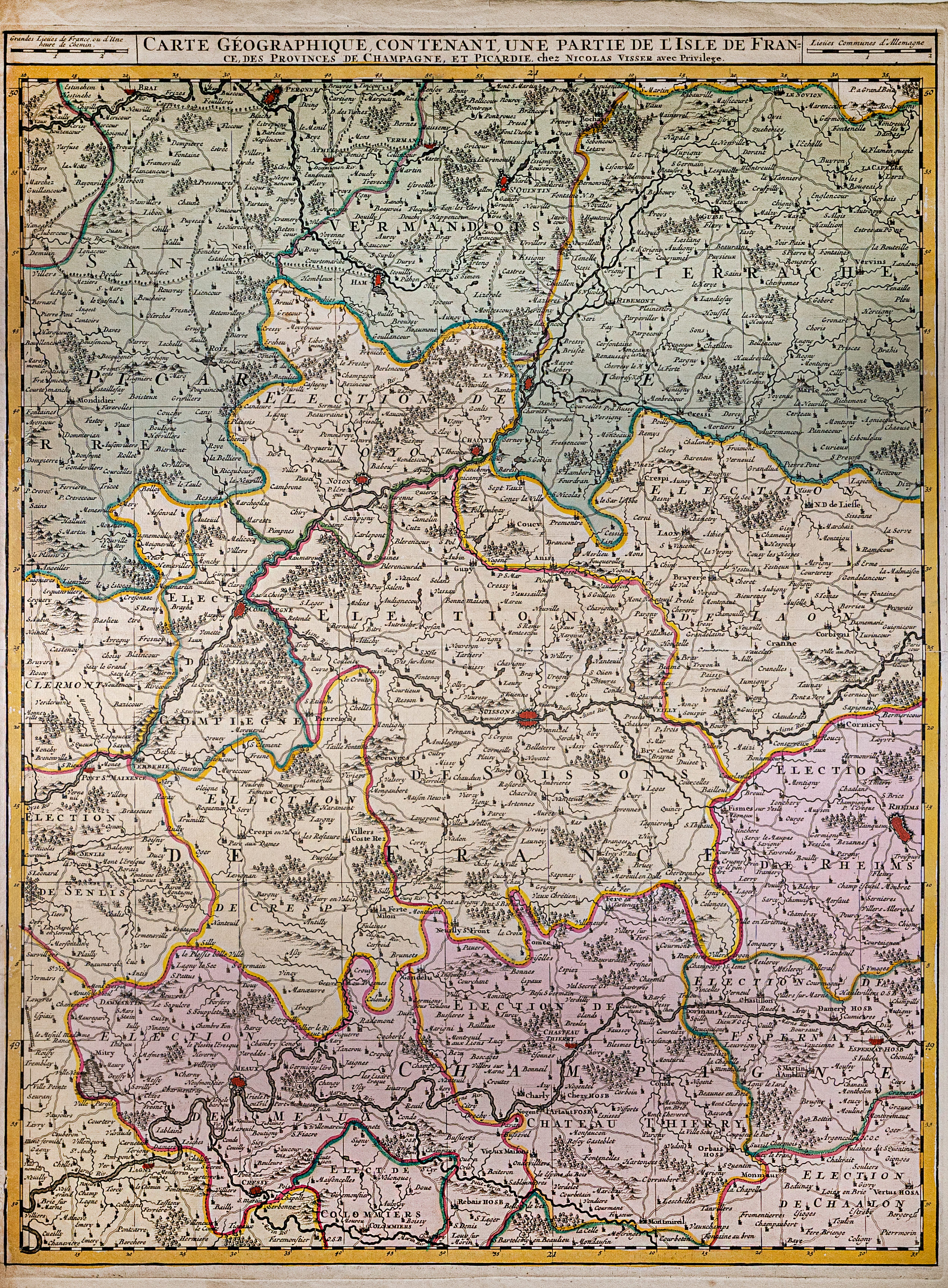
Carte Géographique Contenant une Partie de de l’isle de France des Provinces de Champagne, et Picardie
Classroom and Research opportunities.
Taking the lead on creating an online catalog for the Horowitz Map Collection.
Professor Claire Campbell and HIST 215 – Mapping History Course work toward creating a digital gallery of the map collection.
View the Horowitz Map Collection.
The Horowitz Map Collection
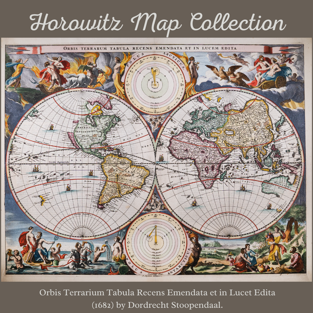
This map showcases the layout of the entire globe as it was understood to exist at the same by Dutch society. The map depicts major…
The Horowitz Map Collection
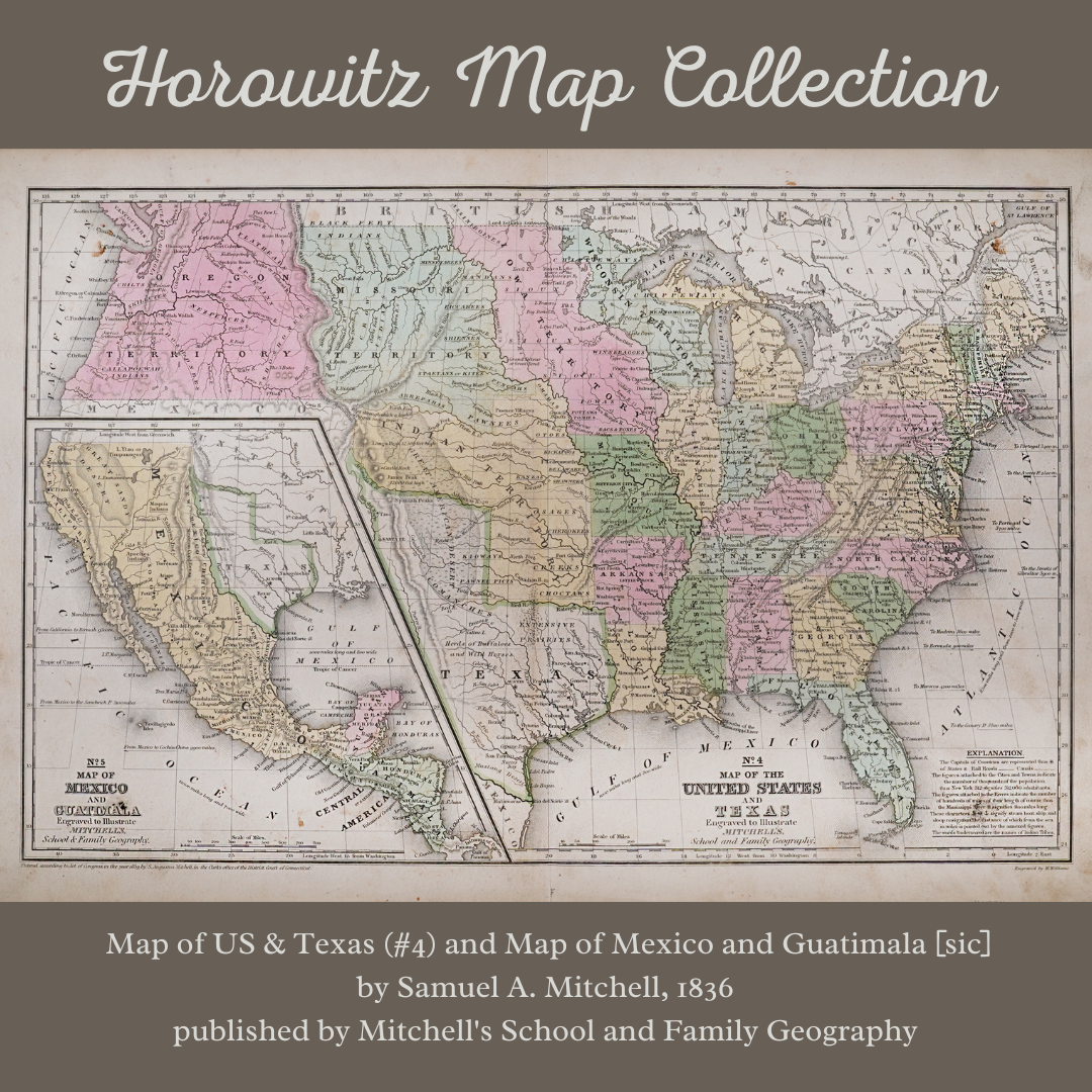
At first glance, the map looks like a typical map of the US, but upon closer inspection, it is much more complex. Mitchell’s map includes…